City of Prince Rupert Landfill Aerial Mapping
Location:
Prince Rupert, BC
Client:
City of Prince Rupert
Project Type:
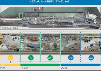
Aerial TopographyDroneX conducts regular aerial photogrammetric surveys for volumetric analysis at this 35-hectare site. Outputs included high resolution orthomosaic photo and surface topography at 2.5 cm resolution.